Half Dome above the Merced River from Sentinel Bridge in Yosemite Valley

The Basecamping Field Guide · Yosemite

Find your basecamp in Yosemite

Compare places to camp, understand when reservations open, and plan a trip with the right campsite, rental RV, and nearby adventures.

Explore campgrounds
Half Dome and the Merced River · Yosemite ValleyPhoto: NPS / Eric Bissmeyer · Recreation.govUpdated Nov 5, 2026

Where should you camp?

Stay close to the Valley’s landmarks, make a quieter southern base, or choose a gateway town with more amenities. Start with the experience you want, then compare the drive.

Yosemite camping areas, entrances, and gateway communitiesNumbered camping areas match the area list beside the map: Yosemite Valley, Wawona, Crane Flat, Tuolumne Meadows, and gateway communities outside the park. Entrance symbols mark South, Big Oak Flat, Arch Rock, and Tioga Pass entrances.YOSEMITE NATIONAL PARK1Yosemite Valley2Wawona3Crane Flat4Tuolumne Meadows5GatewaysSouthBig Oak FlatArch RockTioga Pass1Camping areaEntranceSeasonal road
Park boundary: National Park Service. Gateways: El Portal and Groveland west; Oakhurst south; Lee Vining via Tioga Pass. Diamonds mark the four entrances; dashed Highway 120 is seasonal.
1Yosemite ValleyLandmarks and shuttle access

Wake beneath granite walls with Valley trailheads and the free shuttle close by. Best when the iconic sights are your priority; expect the busiest campgrounds, dense development, and the toughest reservations.

Near Valley trailheads and shuttle stops

Explore campgrounds here
2Wawona & the southern approachGiant sequoias and the southern approach

A forested base on the South Fork Merced, convenient for Mariposa Grove and arrivals through Oakhurst. The quieter setting comes with a winding drive to Valley viewpoints rather than walking out your tent flap to them.

About 45 min to Yosemite Valley · Open year-round; winter chains may be required

Explore campgrounds here
3Crane Flat & the western approachValley and high-country day trips

Consider this area if you want to divide your trip between Valley sights and the high country. Compare Crane Flat and Hodgdon Meadow individually—their locations and opening seasons differ.

About 30 min to Yosemite Valley · Crane Flat is seasonal; Hodgdon Meadow is year-round

Explore campgrounds here
4Tuolumne Meadows & the high countryAlpine trails and summer camping

Trade granite Valley walls for open subalpine meadows, domes, and high-country trailheads. This works only when your dates line up with seasonal access; Tioga Road closes in winter and campground opening follows the thaw.

About 2 hr to Yosemite Valley · Seasonal, when Tioga Road is open

Explore campgrounds here
5Outside the parkMore amenities and campground choices

More choice can mean private campgrounds, hookups, cabins, or a different price point. It is a useful fallback when park sites are full, but the tradeoff is a daily entrance drive and more time in the car.

El Portal: about 30 min to Yosemite Valley · Other gateways vary by route and season

Explore campgrounds here

Roads are schematic, not turn-by-turn navigation. Dashed Highway 120 east of Crane Flat is seasonal. Drive times: NPS driving guidance and Recreation.gov campground directions; approximate, in good conditions with no stops. Check current road conditions.

Choose your Yosemite campground

Compare six distinct bases, from Valley landmarks to high-country trails and hookups outside the park.

The Merced River east of Clark’s Bridge near Upper Pines Campground
Eric Bissmeyer, NPS / Recreation.gov

Yosemite Valley

Upper Pines Campground

For a first Yosemite trip

Wake among black oak and ponderosa pine with granite walls overhead, the Merced River nearby, and the free Valley shuttle at the entrance. Choose this if… You want to leave the car parked and spend your days near Valley trailheads, shuttle stops, and the river.

  • Open year-roundTap water and flush toilets
  • RVs up to 35 ftTrailers up to 24 ft
  • 236 campsitesThe Valley’s largest reservation campground
  • No campsite hookupsYear-round dump station

Worth knowing: This is the Valley’s busy center, not a secluded retreat. Valley campfires are limited to 5–10 pm.

View campground
A Wawona campsite with a picnic table, fire ring, and food locker among the pines
NPS / Recreation.gov

Southern Yosemite

Wawona Campground

For giant sequoias and a forested base

Ponderosa pine, incense-cedar, and white fir shade sites beside the South Fork Merced, with Mariposa Grove and Wawona’s meadow close by.

  • Open year-roundReservations required in the main season
  • RVs and trailers up to 35 ftCheck the individual site
  • Tap waterSummer dump station nearby

Worth knowing: You’ll drive to the Valley rather than walk to its trailheads. Winter conditions can require tire chains.

View campground
A typical wooded campsite at Crane Flat Campground
NPS / Recreation.gov

Western approach

Crane Flat Campground

For splitting Valley and high-country days

A spacious, wooded campground at 6,200 feet near the junction for Yosemite Valley and Tioga Road, recently rehabilitated with young plantings between sites.

  • Seasonal2026 season: May 21–Oct 12 · ended
  • RVs and trailers up to 35 ftSite-specific limits apply
  • 148 campsitesTap water and flush toilets

Worth knowing: The season is shorter than at Hodgdon Meadow. Keep wheels and equipment on established pads to protect new plantings.

View campground
A trailer campsite in the trees at Hodgdon Meadow Campground
NPS / Recreation.gov

Big Oak Flat entrance

Hodgdon Meadow Campground

For a year-round western base

Red fir, incense-cedar, and pine surround a meadow near the Big Oak Flat Entrance, with wildflowers in summer and access beyond the peak season.

  • Open year-roundWinter sites are first-come, first-served
  • RVs up to 35 ftTrailers up to 30 ft
  • 100 campsitesTap water and flush toilets

Worth knowing: The campground is a drive from the Valley, and winter services and access vary with weather. Hodgdon campfires are limited to 5–10 pm.

View campground
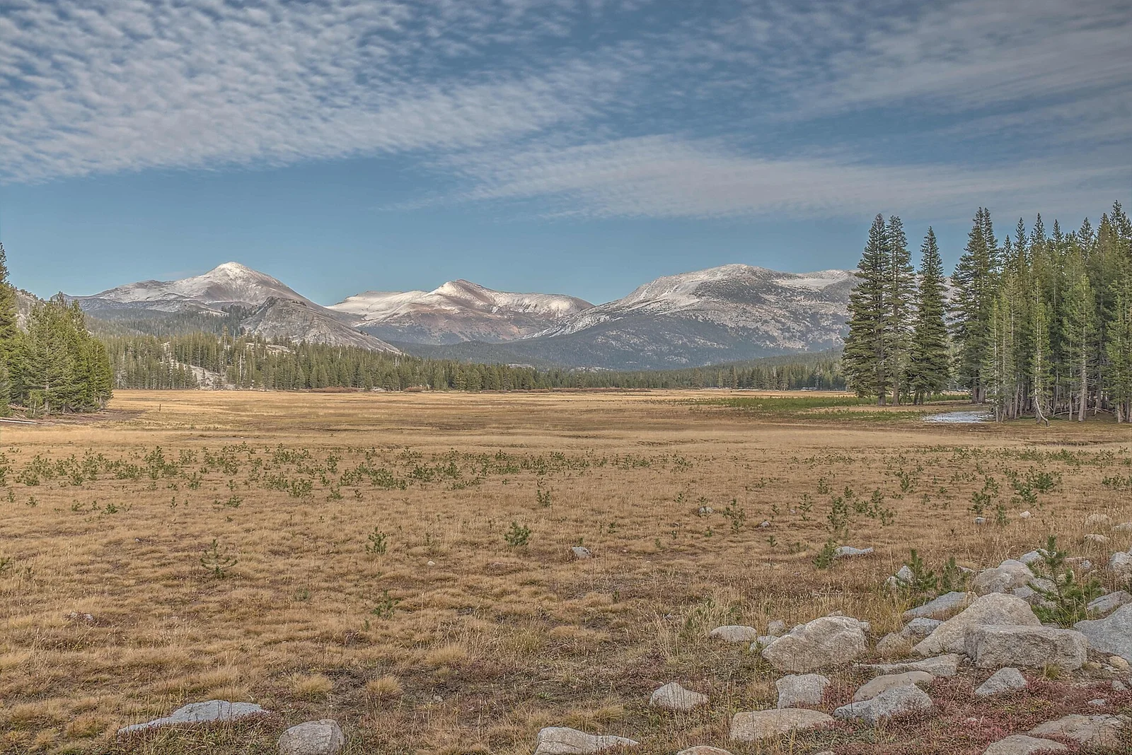
The Tuolumne River winding through Tuolumne Meadows beneath granite domes
Dsdugan / Wikimedia Commons · CC0

High country

Tuolumne Meadows Campground

For alpine trails and cool summer nights

At 8,600 feet, broad subalpine meadows, granite domes, and the Tuolumne River put high-country trailheads within easy reach.

  • Short summer season2026 season: Jul 1–Sep 27 · ended
  • RVs up to 35 ftTrailers up to 24 ft
  • 289 campsitesFamily, group, and horse sites

Worth knowing: Plan around snow, cold nights, and limited opening dates. The Valley is about two hours away; bring a reservation confirmation because connectivity is limited.

View campground
Wooded RV sites at Indian Flat RV Park in El Portal
Indian Flat RV Park / Campspot

El Portal · Outside the park

Indian Flat RV Park

For hookups near the Highway 140 entrance

A small, wooded RV park in the Sierra foothills along the Highway 140 approach, with the Merced River canyon and El Portal close by.

  • Full hookupsElectric, water, and sewer
  • 25 sitesPrivate Campspot listing
  • RVs up to 53 ftConfirm your exact site

Worth knowing: You’ll drive through the entrance for park days. The private setting and full hookups are different from a national-park campsite; compare current nightly pricing and rules before booking.

View campground
Explore the full directory 135 listed campgrounds within 60 miles of Yosemite Valley

Six featured choices are only the starting point. Compare the wider inventory by gateway, equipment fit, hookups, and provider. Distance below is straight-line from Yosemite Valley; driving can be much longer.

Upper Pines CampgroundInside Yosemite · Recreation.gov1.4 miUp to 35 ftNorth Pines CampgroundInside Yosemite · Recreation.gov1.5 miUp to 40 ftLower Pines CampgroundInside Yosemite · Recreation.gov1.6 miUp to 40 ftYosemite Creek CampgroundInside Yosemite · Recreation.gov6.7 miUp to 20 ftBridalveil Creek CampgroundInside Yosemite · Recreation.gov7.1 miUp to 35 ftWhite Wolf CampgroundInside Yosemite · Recreation.gov10.7 miUp to 30 ftTuolumne Meadows CampgroundInside Yosemite · Recreation.gov13.1 miUp to 35 ftWawona CampgroundInside Yosemite · Recreation.gov13.6 miUp to 35 ftCrane Flat CampgroundInside Yosemite · Recreation.gov16.8 miUp to 35 ftHodgdon Meadow CampgroundInside Yosemite · Recreation.gov18.4 miUp to 40 ftIndian Flat RV ParkEl Portal, CA · Campspot17.9 miElectric hookupsSummerdale CampgroundFish Camp, CA · Recreation.gov18.2 miUp to 30 ftDimond OGroveland, CA · Recreation.gov18.6 miUp to 48 ftKelty MeadowOakhurst, CA · Recreation.gov20.9 miUp to 30 ftEl Captain’s View 4X4 ONLY YosemiteEl Portal, CA · Hipcamp21 miUp to 30 ftTexas FlatsOakhurst, CA · Recreation.gov21.9 miUp to 20 ftSilver Lake Campground June Lake (Ca)Mammoth Lakes, CA · Recreation.gov22.6 miUp to 38 ftCamping At Yosemite's DoorstepBuck Meadows, CA · Hipcamp22.7 miUp to 16 ftSoquel CampgroundOakhurst, CA · Recreation.gov23.2 miUp to 30 ftAgnew Meadows Group CampMammoth Lakes, CA · Recreation.gov24.8 miUp to 30 ftReversed Creek CampgroundJune Lake, CA · Recreation.gov24.9 miUp to 45 ftJune LakeMammoth Lakes, CA · Recreation.gov25.4 miUp to 60 ftOh RidgeMammoth Lakes, CA · Recreation.gov25.6 miUp to 50 ftLundy Lake ResortLee Vining, CA · Campspot25.8 miElectric hookupsYosemite Foothills CampMariposa, CA · Hipcamp25.8 miElectric hookupsMeadow View HavenBootjack, CA · Hipcamp25.9 miElectric hookupsChilkootOakhurst, CA · Recreation.gov25.9 miUp to 54 ftLittle Piece of YosemiteMariposa, CA · Hipcamp26 miElectric hookupsPumice Flat Group CampMammoth Lakes, CA · Recreation.gov26.2 miUp to 40 ftTrumbull LakeVirginia Lakes, CA · Recreation.gov26.2 miUp to 82 ftGranite Ridge RV Park and HotelOakhurst, CA · Hipcamp26.5 miElectric hookupsYosemite Southgate Campground *OYBCOakhurst, CA · Hipcamp26.6 miCheck equipment fitCherry ValleyGroveland, CA · Recreation.gov26.7 miUp to 70 ftYosemite Colfax SpringGroveland, CA · Hipcamp27.2 miElectric hookupsCamp with CrittersBootjack, CA · Hipcamp27.9 miElectric hookupsCamp SourBerry (near Yosemite)Oakhurst, CA · Hipcamp28.2 miUp to 45 ftLost ClaimGroveland, CA · Recreation.gov28.4 miUp to 15 ftObsidian FlatMammoth Lakes, CA · Recreation.gov28.5 miUp to 40 ftOutdoorsy Yosemite CampgroundBass Lake, CA · Hipcamp29 miElectric hookupsGreen Creek GroupBridgeport, CA · Recreation.gov29.2 miUp to 45 ftMammoth PoolNorth Fork, CA · Recreation.gov29.7 miUp to 30 ftForks Campground (Sierra)Bass Lake, CA · Recreation.gov29.8 miUp to 40 ftCedar BluffBass Lake, CA · Recreation.gov29.9 miUp to 50 ftLupineBass Lake, CA · Recreation.gov29.9 miUp to 40 ftTwin Lakes CampgroundMammoth Lakes, CA · Recreation.gov30.3 miUp to 55 ftSpring CoveBass Lake, CA · Recreation.gov30.4 miUp to 42 ftLake Mary CampgroundMammoth Lakes, CA · Recreation.gov30.5 miUp to 21 ftWishon Bass LakeBass Lake, CA · Recreation.gov30.7 miUp to 26 ftColdwater Campground - Inyo Nf (Ca)Mammoth Lakes, CA · Recreation.gov31.2 miUp to 43 ftLower Twin Lakes at BridgeportTwin Lakes, CA · Recreation.gov31.8 miUp to 35 ftYosemite Westlake CampGreeley Hill, CA · Hipcamp32.1 miElectric hookupsNew Shady Rest CampgroundMammoth Lakes, CA · Recreation.gov32.1 miUp to 41 ftOld Shady Rest CampgroundMammoth Lakes, CA · Recreation.gov32.1 miUp to 58 ftPine GlenMammoth Lakes, CA · Recreation.gov32.3 miUp to 65 ftPahaTwin Lakes, CA · Recreation.gov32.3 miUp to 45 ftCrags CampgroundBridgeport, CA · Recreation.gov32.4 miUp to 45 ftRobinson Creek NorthBridgeport, CA · Recreation.gov32.9 miUp to 40 ftRobinson Creek SouthBridgeport, CA · Recreation.gov32.9 miUp to 40 ftSherwin CreekMammoth Lakes, CA · Recreation.gov33.7 miUp to 60 ftHoneymoon FlatTwin Lakes, CA · Recreation.gov33.8 miUp to 45 ftBagby Campground and Recreation Area - Mariposa, CAMariposa, CA · Campspot33.9 miElectric hookupsRed Tail Ranch at YosemitePine Mountain Lake, CA · Hipcamp33.9 miElectric hookupsFish Creek (Ca)North Fork, CA · Recreation.gov34.7 miUp to 20 ftBaseCampByBo!Groveland, CA · Hipcamp34.9 miUp to 19 ftYosemite RV ResortCoarsegold, CA · Spot2Nite35.6 miElectric hookupsWillow Springs ResortBridgeport, CA · Hipcamp35.9 miElectric hookupsPapa Allen's glamping spotCoarsegold, CA · Hipcamp35.9 miCheck equipment fitYosemite Pines RV Resort and Family LodgingGroveland, CA · Campspot36.4 miElectric hookupsAce's Yosemite Hide OutCoarsegold, CA · Hipcamp37 miUp to 34 ftTimberCampGroveland, CA · Hipcamp37.4 miUp to 25 ftHorseshoe Bend Campground and Recreation Area - Coulterville, CACoulterville, CA · Campspot38.4 miElectric hookupsWillow Belle RanchNorth Fork, CA · Hipcamp38.6 miCheck equipment fitHeart valley ranchGroveland, CA · Hipcamp38.7 miUp to 30 ftConvict Lake CampgroundCrowley Lake, CA · Recreation.gov38.8 miUp to 55 ftLower Billy CreekLakeshore, CA · Recreation.gov38.8 miUp to 38 ftUpper Billy Creek CgLakeshore, CA · Recreation.gov38.8 miUp to 40 ftCataveeLakeshore, CA · Recreation.gov39.1 miUp to 30 ftDeer CreekLakeshore, CA · Recreation.gov39.2 miUp to 40 ftKinnikinnickLakeshore, CA · Recreation.gov39.2 miUp to 40 ftLakeshore ResortShaver Lake, CA · Hipcamp39.2 miElectric hookupsRiver Ranch CampgroundsTwain Harte, CA · Hipcamp39.2 miUp to 40 ftPioneer TrailStrawberry, CA · Recreation.gov39.3 miUp to 40 ftRancheriaBig Creek, CA · Recreation.gov39.6 miElectric hookupsDiamond GulchGroveland, CA · Hipcamp39.6 miUp to 40 ftBadger Flats GroupBig Creek, CA · Recreation.gov39.8 miUp to 35 ftMeadowview CampgroundPinecrest, CA · Recreation.gov39.8 miUp to 49 ftPinecrestPinecrest, CA · Recreation.gov39.8 miUp to 48 ftBridgeport Reservoir Marina and CampgroundBridgeport, CA · Spot2Nite41 miElectric hookupsThree Links CampgroundsMi-Wuk Village, CA · Spot2Nite41 miElectric hookupsBarrett Cove Campground and Recreation Area - La Grange, CALake Don Pedro, CA · Campspot41.5 miElectric hookupsParadise Shores CampBridgeport, CA · Hipcamp41.6 miElectric hookupsMcClure Point Campground and Recreation Area - Snelling, CASnelling, CA · Campspot41.6 miElectric hookupsRV Park at Black Oak CasinoTuolumne City, CA · Campspot41.7 miElectric hookupsMcgee CreekMammoth Lakes, CA · Recreation.gov43 miUp to 35 ftCodorniz Recreation Area CampgroundRaymond, CA · Recreation.gov43.4 miElectric hookupsWildcat Recreation Area CampgroundRaymond, CA · Recreation.gov43.8 miUp to 50 ftShangrilog Near YosemiteTwain Harte, CA · Hipcamp43.9 miUp to 20 ftGreen Acres slipSonora, CA · Hipcamp44 miElectric hookupsLake McSwain Campground and Recreation Area - Snelling, CASnelling, CA · Campspot44.7 miElectric hookupsClose to Yosemite-Gold Rush Camp SiCedar Ridge, CA · Hipcamp45.1 miUp to 55 ftDorabelle CampgroundShaver Lake, CA · Recreation.gov45.3 miUp to 35 ftCoe's Cozy Country CornerAuberry, CA · Hipcamp46 miUp to 38 ftHaven LakeAuberry, CA · Hipcamp46.2 miUp to 30 ftDenham Forest 100 Acre&Private LakeAuberry, CA · Hipcamp46.7 miUp to 65 ftHidden ViewRaymond, CA · Recreation.gov47 miElectric hookupsAspen Group (Inyo)Mammoth Lakes, CA · Recreation.gov47.6 miUp to 30 ftRock Creek Lake (Inyo National Forest, Ca)Swall Meadows, CA · Recreation.gov48 miCheck equipment fitEast Fork Campground – Inyo National Forest (Ca)Swall Meadows, CA · Recreation.gov48.3 miUp to 38 ftMommapeggs Getaway in the SierraChinese Camp, CA · Hipcamp48.4 miUp to 35 ftPalisades Group CampgroundTom's Place, CA · Recreation.gov48.4 miUp to 40 ftFrench CampMammoth Lakes, CA · Recreation.gov48.8 miUp to 35 ftLDMA Italian BarColumbia, CA · Hipcamp49.1 miUp to 30 ftTuff CampgroundSunny Slopes, CA · Recreation.gov49.4 miUp to 45 ftMillerton Lake SRAFriant, CA · State parks50.3 miElectric hookupsDinkey CreekShaver Lake, CA · Recreation.gov51.1 miUp to 50 ftSquirrel Rock RV CampgroundColumbia, CA · Hipcamp51.4 miElectric hookupsHistorical Columbia CampgroundColumbia, CA · Hipcamp52.2 miUp to 26 ftWalker River State Recreation AreaYerington, NV · State parks54.8 miElectric hookupsTuttletown Recreation AreaSonora, CA · Recreation.gov55.5 miUp to 40 ftGolden Pines RV ResortArnold, CA · Campspot55.9 miElectric hookupsBig Meadow - Us Forest Service Stanislaus National Forest (Ca)Bear Valley, CA · Recreation.gov55.9 miUp to 53 ftColeville / Walker KOA HolidayColeville, CA · KOA55.9 miCheck equipment fitCalaveras Big Trees SPArnold, CA · State parks56 miUp to 30 ftScottie's MotofarmForest Meadows, CA · Hipcamp56 miUp to 30 ftSierra Circles Sculpture GardenForest Meadows, CA · Hipcamp56.1 miUp to 28 ftThe Land Of Make+BelieveMurphys, CA · Hipcamp56.2 miUp to 33 ft(Lake Alpine) Silver Valley CampgroundCarson City, NV · Recreation.gov56.5 miUp to 53 ftA & M Ranch Central CalMadera Ranchos, CA · Hipcamp56.8 miUp to 40 ft(Lake Alpine) Lodgepole CampgroundBear Valley, CA · Recreation.gov57.3 miUp to 50 ft(Lake Alpine) Silver Tip CampgroundCarson City, NV · Recreation.gov57.3 miElectric hookupsGlory Hole Recreation AreaAngels Camp, CA · Recreation.gov57.7 miUp to 90 ftMighty Farm & CampForest Meadows, CA · Hipcamp58.1 miUp to 30 ftThe Painted LakeAngels Camp, CA · Hipcamp59.1 miElectric hookupsAngels Camp RV and Camping ResortAngels Camp, CA · Hipcamp59.2 miElectric hookupsTrimmer CampgroundPiedra, CA · Recreation.gov59.4 miUp to 30 ft

Park campground facts and seasons: NPS campground table, checked Nov 5, 2026. Private-campground details come from its Campspot listing. Verify equipment limits, opening dates, and rules on the individual campsite before booking.

When to go

Yosemite’s 2,000-to-13,000-foot elevation range makes “the season” different in every area. Choose your activities first, then match them to the access and weather you can realistically expect.

Spring · March–June

Waterfalls and a changing snow line

Lower elevations green up while higher trails can remain snowy. Tioga Road usually opens in late May or June, and campgrounds may take several more weeks to prepare. Pack waterproof layers and check trail and road conditions.

Good fit: Valley and Wawona in spring; high country only as access opens.

Summer · July–August

The fullest access—and the greatest demand

Most trails and campgrounds are typically accessible by early July. Valley days can be hot; Tuolumne Meadows is cooler, with nights sometimes near freezing. Afternoon thunderstorms and regional wildfire smoke are possible.

Good fit: High-country trips, family RV trips, and reserved Valley stays.

Fall · September–October

Cooler days with a shorter seasonal window

Early fall can bring comfortable hiking weather, but smaller streams may be low and smoke is possible. Seasonal campgrounds begin closing; overnight parking restrictions on Tioga and Glacier Point Roads start October 15, and early snow can close access.

Good fit: September high-country trips and October Valley stays with flexible backup plans.

Winter · November–February

A quieter, snow-ready Yosemite

Upper Pines takes reservations all year; Camp 4, Wawona, and Hodgdon Meadow are first-come, first-served in winter and can fill on weekends and holidays. Carry tire chains, expect snow at elevation, and keep extra food and shelter plans ready.

Good fit: Valley camping with realistic cold-weather preparation.

When to book

Yosemite campgrounds release reservations on different schedules. Non-lottery releases happen at 7 am Pacific and can sell out within minutes, so sign in to Recreation.gov and be ready before release time.

CampgroundReservation releasePlanning note
Upper, Lower & North Pines · Wawona · Hodgdon MeadowFive months ahead on the 15thArrival-date blocks run from the 15th through the 14th of the next month. Only Upper Pines takes reservations all year.
Tuolumne MeadowsHalf two months ahead on the 15th · half 14 days aheadA short summer season and two separate releases—check both.
Crane Flat · Bridalveil Creek · Tamarack Flat · White Wolf · Yosemite Creek · Porcupine FlatRolling daily window 14 days aheadOpening and closing dates are tentative and vary by campground.
Camp 4Rolling daily window 7 days ahead in its reservation seasonTents only; no RVs or trailers. First-come, first-served outside the reservation season.
1

Find your arrival block. For the five-month campgrounds, arrivals May 15–June 14 open January 15; June 15–July 14 open February 15, and so on.

2

Prepare before 7 am Pacific. Sign in, confirm the exact equipment and site length, and know your next-choice campground.

3

If your first choice is full, keep options open. Check cancellations, compare another area, and use live availability below for both park and gateway campgrounds.

See the official reservation schedules and arrival-date table

Official rules checked Nov 5, 2026. NPS notes that North Pines may also use a lottery. Opening dates and reservation seasons can change; the linked official page is the authority for your trip.

See what’s open for your trip

Choose your dates and camping setup to compare matching sites inside and around Yosemite. Results only say “available” when our provider feed confirms sites for the whole stay.

Start with your datesYou can also add RV length and party details.

Yosemite Valley · Recreation.gov

Upper Pines Campground

Add dates to check which individual sites are open for the full stay.

View campground

Southern Yosemite · Recreation.gov

Wawona Campground

Add dates to check which individual sites are open for the full stay.

View campground

Western approach · Recreation.gov

Crane Flat Campground

Add dates to check which individual sites are open for the full stay.

View campground
View all matching campsites

Live results update with your dates. Search includes the wider Yosemite-area catalog, not only these six recommendations. Price is nightly where supplied; taxes and fees are not included.

Arrive and pick up your RV

Fly in and rent an RV

Compare four real pickup regions. The listings below are examples from our current rental feed—not a promise of availability for your dates. Confirm airport transfer, total price, and site fit with the provider.

Fresno Yosemite International (FAT)FresnoAbout 2 hr 30 min to Upper Pines from the featured pickups

A Yosemite-focused southern approach

Choose Fresno for the shortest drive of these four options. Pick up near the airport, stock up in town, then follow Highway 41 through Oakhurst and Wawona.

1FATArrive
2RV pickupFresno
3YosemiteYour basecamp
Pick up your RV near Fresno
Each card shows an airport-to-listing road estimate. Transfer is not included unless your host agrees.
Suggested campground areas
Wawona · Upper Pines · Summerdale
Sample itinerary
Set up at Wawona, visit Mariposa Grove the next morning, then continue to the Valley for your final night.
Route details

OSRM road estimates from each listing’s published coordinates to Upper Pines, calculated Nov 5, 2026 in good conditions with no stops. Airport transfers use the same method. Actual routes, traffic, weather, and pickup arrangements vary. NPS airport guidance gives about 2½ hr FAT–Valley, 4 hr SFO–Valley, 3½ hr SMF–Valley, and 4½ hr RNO–Valley when Tioga Road is open.

Brand New 2025 Winnebago Solis NPF Yosemite ready

Compact campervan

Outdoorsy

Brand New 2025 Winnebago Solis NPF Yosemite ready

21 ft · Sleeps 4 · 4 belted seats

A nimble choice for couples or a small crew prioritizing mountain-road handling.

Fresno Yosemite International → pickup About 11 min · 6 mi

Pickup → Upper Pines About 2 hr 30 min · 92 mi

$248 / night listed, before fees

View on Outdoorsy
Compare Fresno RV rentals
2020 Thor Four Winds

Family motorhome

Outdoorsy

2020 Thor Four Winds

24 ft · Sleeps 4 · 4 belted seats

More room to settle in, with sleeping space for a family Yosemite trip.

Fresno Yosemite International → pickup About 12 min · 6 mi

Pickup → Upper Pines About 2 hr 30 min · 94 mi

$135 / night listed, before fees

View on Outdoorsy
Compare Fresno RV rentals

In rental search, add your dates and filter by travelers, belted seats, sleeping capacity, and vehicle length where those filters are available. Belted seats—not just sleeping capacity—determine how many people can ride.

San Francisco International (SFO)San Francisco Bay AreaAbout 4 hr 30 min to 4 hr 40 min to Upper Pines

A city stay followed by Yosemite

Pair a Bay Area arrival with a campervan or compact motorhome. Continue through the Central Valley and approach Yosemite on Highway 140 or Highway 120.

1SFOArrive
2RV pickupSan Francisco Bay Area
3YosemiteYour basecamp
Pick up your RV near San Francisco Bay Area
Each card shows an airport-to-listing road estimate. Transfer is not included unless your host agrees.
Suggested campground areas
Hodgdon Meadow · Indian Flat · Upper Pines
Sample itinerary
Break up the arrival with a supply stop, settle in near the western entrance, and leave the next full day for the Valley.
Route details

OSRM road estimates from each listing’s published coordinates to Upper Pines, calculated Nov 5, 2026 in good conditions with no stops. Airport transfers use the same method. Actual routes, traffic, weather, and pickup arrangements vary. NPS airport guidance gives about 2½ hr FAT–Valley, 4 hr SFO–Valley, 3½ hr SMF–Valley, and 4½ hr RNO–Valley when Tioga Road is open.

2023 Ford Transit Campervan-Fully Loaded

Compact campervan

Outdoorsy

2023 Ford Transit Campervan-Fully Loaded

22 ft · Sleeps 2 · 2 belted seats

A nimble choice for couples or a small crew prioritizing mountain-road handling.

San Francisco International → pickup About 10 min · 4 mi

Pickup → Upper Pines About 4 hr 35 min · 187 mi

$217 / night listed, before fees

View on Outdoorsy
Compare San Francisco Bay Area RV rentals

In rental search, add your dates and filter by travelers, belted seats, sleeping capacity, and vehicle length where those filters are available. Belted seats—not just sleeping capacity—determine how many people can ride.

Sacramento International (SMF)SacramentoAbout 4 hr 5 min to 4 hr 15 min to Upper Pines

A Northern California departure

A practical comparison if flights into Sacramento fit your trip better. Head south and east toward Highway 120, then use the Big Oak Flat approach.

1SMFArrive
2RV pickupSacramento
3YosemiteYour basecamp
Pick up your RV near Sacramento
Each card shows an airport-to-listing road estimate. Transfer is not included unless your host agrees.
Suggested campground areas
Hodgdon Meadow · Crane Flat · Upper Pines
Sample itinerary
Pick up and provision near Sacramento, camp on the western approach, then make a relaxed Valley arrival the following morning.
Route details

OSRM road estimates from each listing’s published coordinates to Upper Pines, calculated Nov 5, 2026 in good conditions with no stops. Airport transfers use the same method. Actual routes, traffic, weather, and pickup arrangements vary. NPS airport guidance gives about 2½ hr FAT–Valley, 4 hr SFO–Valley, 3½ hr SMF–Valley, and 4½ hr RNO–Valley when Tioga Road is open.

Tiny RV for two

Compact campervan

RVshare

Tiny RV for two

17 ft · Sleeps 2 · 2 belted seats

A nimble choice for couples or a small crew prioritizing mountain-road handling.

Sacramento International → pickup About 16 min · 11 mi

Pickup → Upper Pines About 4 hr 5 min · 166 mi

$90 / night listed, before fees

View on RVshare
Compare Sacramento RV rentals
2012 Thor Majestic Fully Stocked

Family motorhome

RVshare

2012 Thor Majestic Fully Stocked

29 ft · Sleeps 6 · 7 belted seats

More room to settle in, with sleeping space for a family Yosemite trip.

Sacramento International → pickup About 16 min · 9 mi

Pickup → Upper Pines About 4 hr 10 min · 169 mi

$150 / night listed, before fees

View on RVshare
Compare Sacramento RV rentals
2012 Forest River Sunseeker

Family motorhome

Outdoorsy

2012 Forest River Sunseeker

32 ft · Sleeps 9 · Seatbelt count not listed

More room to settle in, with sleeping space for a family Yosemite trip.

Sacramento International → pickup About 21 min · 13 mi

Pickup → Upper Pines About 4 hr 5 min · 165 mi

$150 / night listed, before fees

View on Outdoorsy
Compare Sacramento RV rentals

In rental search, add your dates and filter by travelers, belted seats, sleeping capacity, and vehicle length where those filters are available. Belted seats—not just sleeping capacity—determine how many people can ride.

Reno–Tahoe International (RNO)Reno / Eastern SierraAbout 5 hr 15 min to Upper Pines via Tioga Road

An Eastern Sierra journey

Make the drive part of the trip: follow Highway 395 past Mono Lake to Lee Vining, cross Tioga Pass when it is open, and spend time in the high country before the Valley.

1RNOArrive
2RV pickupReno / Eastern Sierra
3YosemiteSeasonal Tioga route
Pick up your RV near Reno / Eastern Sierra
Each card shows an airport-to-listing road estimate. Transfer is not included unless your host agrees.
Suggested campground areas
Tuolumne Meadows · Lee Vining area · Upper Pines
Sample itinerary
Stop at Mono Lake, cross Tioga Pass in daylight, camp at Tuolumne Meadows, and continue to the Valley the next day.

Seasonal access: Tioga Road is typically open late May or June until sometime in November. When closed, there is no vehicle access to Tuolumne Meadows from Reno; NPS estimates about 5 hr 30 min from RNO to Yosemite Valley by the long western detour. Never plan this route around Tioga Pass without checking current conditions.

Route details

OSRM road estimates from each listing’s published coordinates to Upper Pines, calculated Nov 5, 2026 in good conditions with no stops. Airport transfers use the same method. Actual routes, traffic, weather, and pickup arrangements vary. NPS airport guidance gives about 2½ hr FAT–Valley, 4 hr SFO–Valley, 3½ hr SMF–Valley, and 4½ hr RNO–Valley when Tioga Road is open.

Rocky High Roof - 4x4

Compact campervan

Outdoorsy

Rocky High Roof - 4x4

20 ft · Sleeps 2 · 2 belted seats

A nimble choice for couples or a small crew prioritizing mountain-road handling.

Reno–Tahoe International → pickup About 8 min · 4 mi

Pickup → Upper Pines About 5 hr 15 min · 209 mi

$200 / night listed, before fees

View on Outdoorsy
Compare Reno / Eastern Sierra RV rentals
"Amazing Athena" 2010 Winnebago Chalet

Family motorhome

RVshare

"Amazing Athena" 2010 Winnebago Chalet

25 ft · Sleeps 6 · 6 belted seats

More room to settle in, with sleeping space for a family Yosemite trip.

Reno–Tahoe International → pickup About 8 min · 3 mi

Pickup → Upper Pines About 5 hr 20 min · 211 mi

$220 / night listed, before fees

View on RVshare
Compare Reno / Eastern Sierra RV rentals
Fully loaded 2011 Jamboree Motorhome

Family motorhome

Outdoorsy

Fully loaded 2011 Jamboree Motorhome

31 ft · Sleeps 8 · 8 belted seats

More room to settle in, with sleeping space for a family Yosemite trip.

Reno–Tahoe International → pickup About 5 min · 2 mi

Pickup → Upper Pines About 5 hr 20 min · 214 mi

$150 / night listed, before fees

View on Outdoorsy
Compare Reno / Eastern Sierra RV rentals

In rental search, add your dates and filter by travelers, belted seats, sleeping capacity, and vehicle length where those filters are available. Belted seats—not just sleeping capacity—determine how many people can ride.

No hookups inside Yosemite.Plan water, power, and dump-station stops before arrival. Upper Pines has a year-round dump station; Indian Flat outside the park has full hookups.
Match the exact site, not just the RV.Length limits vary by campground and site; back-in pads and turning space matter too. Compare the campsite and rental before paying for either.

Three ways to spend a few days in Yosemite

Use these as starting plans, not packages. Reserve each campsite and rental with its provider, check road and trail conditions, and save the pieces you want to compare.

Half Dome above the Merced River in Yosemite Valley

2 nights · Valley focus

A first Yosemite camping weekend

Keep the driving simple and give the Valley a full day. This plan works best with an Upper Pines reservation and an early arrival.

  • Waterfalls, meadows, and the Merced
  • One last meadow, then pack
View day-by-day plan
  1. Friday · Merced River and camp

    Arrive with daylight to spare, then stretch your legs beside the Merced and settle in beneath the Valley walls.

    Planning note: Check in within your reserved pad, review shuttle stops, and store all food and scented items properly.
  2. Saturday · Waterfalls, meadows, and the Merced

    Spend the morning around Yosemite Falls, explore Cook’s Meadow, and finish with views from Sentinel Bridge. Use the shuttle between stops and leave time to relax at camp.

    Planning note: Valley campfires are limited to 5–10 pm.
  3. Sunday · One last meadow, then pack

    Take a slow breakfast and make a final meadow stop before pointing the car toward home.

    Planning note: Leave no food or trash behind and check road conditions before driving out.
A Wawona campsite with a picnic table, fire ring, and food locker among the pines

4 days / 3 nights · Sequoias + Valley

A family RV trip through Fresno

Pair a Fresno pickup with Wawona’s forest setting, then add a Valley day. A compact motorhome keeps mountain roads and individual-site fit more manageable.

  • Among the giant sequoias
  • Yosemite Valley icons
  • Wawona farewell
View day-by-day plan
  1. Day 1 · Forest arrival

    Follow Highway 41 into the pines and enjoy a relaxed first evening beside the South Fork Merced.

    Planning note: Arrange the Fresno pickup, photograph the vehicle, stock up, and arrive at Wawona before dark.
  2. Day 2 · Among the giant sequoias

    Spend the morning beneath Mariposa Grove’s giants, then enjoy Wawona Meadow or the river in the afternoon.

    Planning note: Use only permitted generator hours; there are no campsite hookups.
  3. Day 3 · Yosemite Valley icons

    Make an early start for Yosemite Falls, Cook’s Meadow, and a shuttle-linked day among the Valley landmarks.

    Planning note: Return to Wawona or use a separately reserved Valley site; never assume you can switch sites on arrival.
  4. Day 4 · Wawona farewell

    Take one final forest walk or meadow pause before the drive home.

    Planning note: Check Highway 41 conditions and leave your site clean.
Tuolumne River and granite domes in Yosemite’s high country

4 days / 3 nights · Tioga Road, when open

A summer high-country trip

Build the trip around Tuolumne Meadows rather than treating it as an add-on to the Valley. Confirm both the road and campground are open before committing to this route.

  • High-country trails
  • Domes and Tenaya Lake
  • A last meadow morning
View day-by-day plan
  1. Day 1 · Mono Lake to Tuolumne Meadows

    Pause beside Mono Lake, cross the Sierra on Highway 120, and finish with an easy walk to Soda Springs and Parsons Lodge.

    Planning note: Cross Tioga Pass in daylight, bring water and supplies, and confirm both road and campground are open.
  2. Day 2 · High-country trails

    Choose Cathedral Lakes, Elizabeth Lake, or a Lyell Canyon walk according to conditions and your group.

    Planning note: Carry layers for rapid weather changes and expect cool nights even in midsummer.
  3. Day 3 · Domes and Tenaya Lake

    Spend another morning among the high-country domes, then pause at Tenaya Lake before continuing west.

    Planning note: Allow about two hours to the Valley and keep a separate campsite reservation if staying there.
  4. Day 4 · A last meadow morning

    Take a final riverside walk before descending toward your next base or the drive home.

    Planning note: Recheck Tioga Road if returning east and do not rely on mobile connectivity.

Before you reserve and before you drive

Small logistics shape a Yosemite camping trip. Keep these official rules and service details beside your campsite and rental choices.

Reservations and arrival

A camping reservation does not include the park entrance fee. Bring proof of your reservation and confirm any separate entrance requirements for your dates.

RVs, trailers, and generators

No Yosemite campsite has electric, water, or sewer hookups. RV and trailer limits differ by campground and site. Generator hours are 7–9 am, noon–2 pm, and 5–7 pm.

Food storage and wildlife

Use the provided food locker and follow campground instructions for every food and scented item. At Tuolumne Meadows, Recreation.gov says food must not be stored in vehicles.

Fires and firewood

Valley and Hodgdon Meadow campfires are limited to 5–10 pm. Check current fire restrictions and buy or gather firewood locally where permitted; don’t move firewood long distances.

Roads and changing conditions

Tioga and Glacier Point Roads close seasonally. Carry chains in late fall, winter, and early spring, and check conditions before every driving day.

Showers, water, and dump stations

Showers are available for a fee at Curry Village’s showerhouse, not in the campgrounds. Upper Pines has a year-round dump station; Wawona’s is summer-only, and NPS says Tuolumne’s is closed until further notice.

Campground details · Camping regulations · Current conditions. Official sources checked Nov 5, 2026.

Sources and latest park information

Rules, seasons, routes, and equipment limits change. Official sources checked Nov 5, 2026; verify details again before you drive or reserve.

Reservations · Campgrounds and RV limits · Camping regulations · Seasons · Current conditions · Driving · Airports · RV rental costs